Mahaweli Complex
 KOTHMALE HYDRO POWER STATION
Kotmale Power Station is a 201MW hydro power project. It is located on Kotmale Oya, Mahaweli river/basin in Central, Sri Lanka. The project is currently active. It has been developed in single phase. Post completion of construction, the project got commissioned in 1985. The project is currently owned by Ceylon Electricity Board. The hydro reservoir capacity is 174 million cubic meter. The net head of the project is 190m. The project generated 420 GWh of electricity.
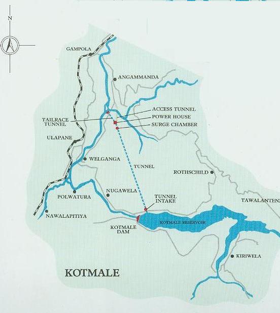
The Kotmale project is one of five major headworks projects being undertaken under the Accelerated Mahaweli Ganga scheme. it is the most upstream of these projects and develops the hydro potential of a major right bank tributary of the Mahaweli Ganga, the Kotmale Oya.
The Kotmale Oya flows through the rural up-country of Sri Lanka passing ancient villages steeped in history and tea plantations of a more recent ara. The tranquility of this river valley has been changed recently with the construction work of the Kotmale Hydropower reservoir. Financial assistance for the project has been provided by the government of Sweden.
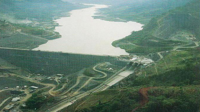
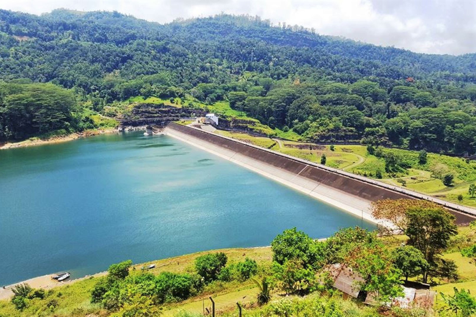
The Kotmale project was one of the first projects taken up under the Accelerated programme for development of the Mahaweli ganga. The basic elements of the project are a dam on the Kotmale Oya ( a tributary of the Mahaweli ganga) and a tunnel system leading to a power station with the outfall of the mahaweli ganga. The primary function of the project is the generation of electric power. Additional benefits will arise from an increase in the amount of irrigation water available at Polgolla due to regulation of flows in the Kotmale Oya.
- Installed capacity : 67 MW X 3
- Expected annual average energy : 450 GWh
- Commissioned in 1988
- Main contractors
- Civil – SKANSKA
- Electromechanical – ASEA
- Hydro mechanical – Kamewa
- Located 20 km south-west of Kandy
- Reservoir
- Catchment area : 544 km2
- Usable water volume : 154 MCM
- Maximum level : 703 m above MSL
- Minimum level : 665 m above MSL
- Gross Storage up to TWL 174mcm
- Dam
- Type - Rockfill with concrete membrane
- Maximum height above bed level – 87m
- Crest Elevation - 706.5m
- Length along crest - 600m
- Spillway
- Numbers & size of gates - 3No. 14mx15m
- Maximum Capacity of spillway - 5550m3/sec
- Diversion Tunnels
- Type – ‘D’ Type Concrete lined
- Numbers and size – 2Nos. 9.2m equivalent diameter
- Length- 746m and 841m
- Maximum Capacity – 1700m3/sec ( in 100 year flood)
- Low pressure Tunnel (Headrace)
- Horseshoe shaped concrete lined
- Total length- 6954m
- Equivalent Diameter – 6.4m
- Maximum Capacity – 113.3m3/sec
- Penstock
- Steel circular, 5.55–4.8m diameter
- 480m in length With surge tank
- Tailrace
- Length : 635 m ; Maximum level : 479 m above MSL; Minimum level : 476 m
above MSL
- Length : 635 m ; Maximum level : 479 m above MSL; Minimum level : 476 m
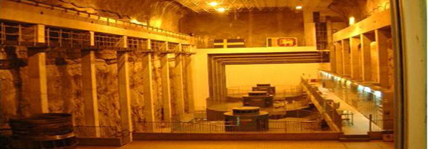
- Generator (ASEA)
- Conventional 03 bearing vertical
- Cooling Closed air/ water cooled
- 90000 kVA, 0.85 PF, 13.8 kV, 3765 A
- 50 Hz, 16 poles, 375 rev/min
- Exciter : 175 V, 1150 A
- Turbine (KAMEWA)
- Vertical Francis
- Output : 67 MW at 201.5 m effective head (Rated), 68.1 MW at 231 m (Gross head 226m)
- Rated discharge : 35 m3/sec
- 375 rev/min