 Mahaweli Complex
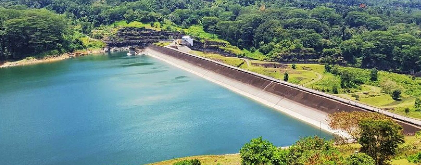


VISION
Enrich life through power
MISSION
Develop and maintain an efficient, coordinated and economical system of electricity supply to the whole of Sri Lanka, while adhering to our core values.
CORE VALUES
Quality Service to the Nation Safety Professionalism Sustainability CommitmentMahaweli Complex Hydro Power Plants — Operating Status
| Plant / Unit | VICTORIA | KOTHMALE | RANDENIGALA | RANTAMBE | UPPER KOTHMALE | UKUWELA | BOWATHANNE | NILAMBE |
|---|---|---|---|---|---|---|---|---|
| Unit 01 | ||||||||
| Unit 02 | ||||||||
| Unit 03 |
Hydro Power — Daily & Annual Energy Generation in 2026 (GWh)
| VICTORIA | KOTHMALE | RANDENIGALA | RANTAMBE | UPPER KOTHMALE | UKUWELA | BOWATHENNA | NILAMBE | |
|---|---|---|---|---|---|---|---|---|
| Daily Gen. on latest date | ||||||||
| Annual Gen. | ||||||||
| Expected Annual Gen. | ||||||||
| Latest Date of data |
Thambapawani Wind Power Plant — Operating Status & Energy Data
Wind Turbine Generators Operating Status (Number of units indicated)
Major Reservoir Water Levels & Active Storage Percentage — 6:00 AM
Kothmale Reservoir
Victoria Reservoir
Randenigala Reservoir
About Us
Electricity Generation Lanka (PVT) LTD
Electricity in Sri Lanka is generated from three primary sources — Hydropower, Thermal (coal and fuel oil), and Non-Conventional Renewable Energy (solar, wind, biomass). The main sub-units are Mahaweli Complex, Laxapana Complex, Samanala Complex (all Hydro) and Thermal Complex.
Mahaweli Complex
Mahaweli Complex is the largest Power Complex in the Generation Division with a generating capacity of 916.7 MW, producing over 2,500 GWh annually. The Complex comprises eight hydro power stations and one wind power station: Victoria, Randenigala, Rantambe, Kothmale, Upper Kothmale, Ukuwela, Bowatenna, Nillambe (Hydro) and Thambapawani (Wind).